10-year anniversary of the M6.2 Eketāhuna earthquake
10 years ago, on 20 January 2014 at 3:52 pm a M6.2 earthquake occurred 15 km east of Eketāhuna, under the south-east of the North Island. The quake was felt strongly in both islands, with multiple reports of damage.
The Eketāhuna earthquake occurred in a seismically active area of New Zealand that extends from Wellington to the Gisborne region. It is a geologically complex area where the Pacific tectonic plate is being subducted beneath the Australian plate at a rate of approximately 42mm per year. The earthquake occurred in the subducting Pacific plate and the aftershocks occurred mostly in the Pacific plate rather than the overlying Australian plate (see image below).
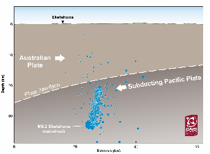
Cross-section through the earth below the Wairarapa. The mainshock and most of the aftershocks were occurring in the crust of the Pacific plate, which is diving below the Australian plate. Aftershocks between 20-22 January are plotted.
Maximum peak ground acceleration recorded by our instruments was about one quarter of the acceleration due to gravity (0.26 g) - this measurement was recorded in Woodville. Relatively strong shaking was also recorded on the Kāpiti Coast (e.g. up to 0.2 g in Paraparaumu) although accelerations recorded in Wellington city were less than 0.05 g. In comparison, ground motions recorded in Wellington during the Cook Strait earthquakes six months earlier ranged up to 0.26 g.
The focal mechanism showed it to be a normal fault earthquake.
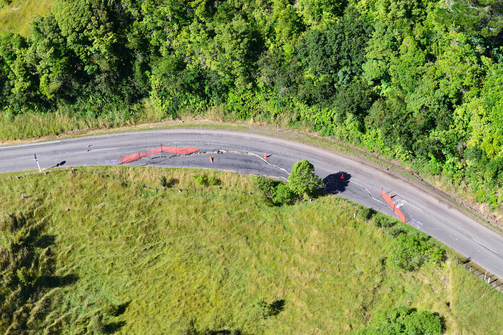
Damage to a road in Eketāhuna from the Earthquake
An Earthquake First
A first for this event, just days after the earthquake, was the creation of possible future forecast scenarios of earthquakes in the area, by GNS scientists. They represented a breakthrough in the presentation of earthquake knowledge and allowed responding agencies and the community to be better informed.
The complex nature of the area meant there were a few possibilities for what could happen next. History gave a clue: from 1940 till 2014, there had been 31 earthquakes of similar magnitude in this area each with their own aftershock sequence. Included in the total of 31 quakes, there were two historical examples where a large earthquake had been followed by quakes of a similar or greater size.
Scientists considered the likelihood of three possible scenarios that could occur in the weeks following the earthquake. These were based on understanding of tectonics in the region, data from the current quake, historical observations, and statistical models. The scenarios were: 1. Aftershocks continuing to decrease in frequency (most likely), 2. another earthquake occurring with a similar size (very unlikely, 3. a larger magnitude quake occurring (extremely unlikely).
Although there were historic examples of scenario two occurring nearby in the past, for this earthquake, scenario one prevailed and aftershocks decreased in frequency, to the relief of locals.
Earthquake monitoring and forecasting today
Here at GNS Science we are constantly improving our capacity and capability to monitor, measure, respond to and mitigate hazards with advancing global science and an expanding GeoNet network of cutting-edge monitoring equipment and technology.
Ten years on from the Eketāhuna earthquake, the GNS Science 'Rapid Characterisation of Earthquakes and Tsunami (RCET)' Programme is developing models and tools that can rapidly use this wealth of data to assess an earthquake as it happens. One of these tools, Shaking Layers, developed in partnership with GeoNet, was released to the website and app in 2023, providing faster maps of ground shaking information to the public.
If an earthquake were to happen again today, we are better equipped to quickly understand what has occurred and forecast what future seismic activity scenarios may occur.
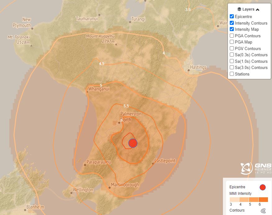
How the ground shaking looked for the earthquake with our new Shaking Layers tool
Earthquakes can occur anywhere in New Zealand at any time. In the event of a large earthquake: Drop, Cover and Hold.
Remember Long or Strong, Get Gone : If you are near the coast and feel a strong earthquake that makes it hard to stand up OR a weak rolling earthquake that lasts a minute or more move immediately to the nearest high ground or as far inland as you can, out of tsunami evacuation zones.
Know what to do?
The National Emergency Management Agency (NEMA) has a great website with information on what to do before, during and after an earthquake.
Prepare your home. Protect your whānau.
There’s a lot we can do to make our homes safer and stronger for natural hazards. Toka Tū Ake EQC’s website has key steps to get you started.
Media Contact: 021 574 541 or media@gns.cri.nz